 |
| isn't it lovely? |
Saturday, July 7, 2012
Natural Wonderland - The Balkans (D3/4)
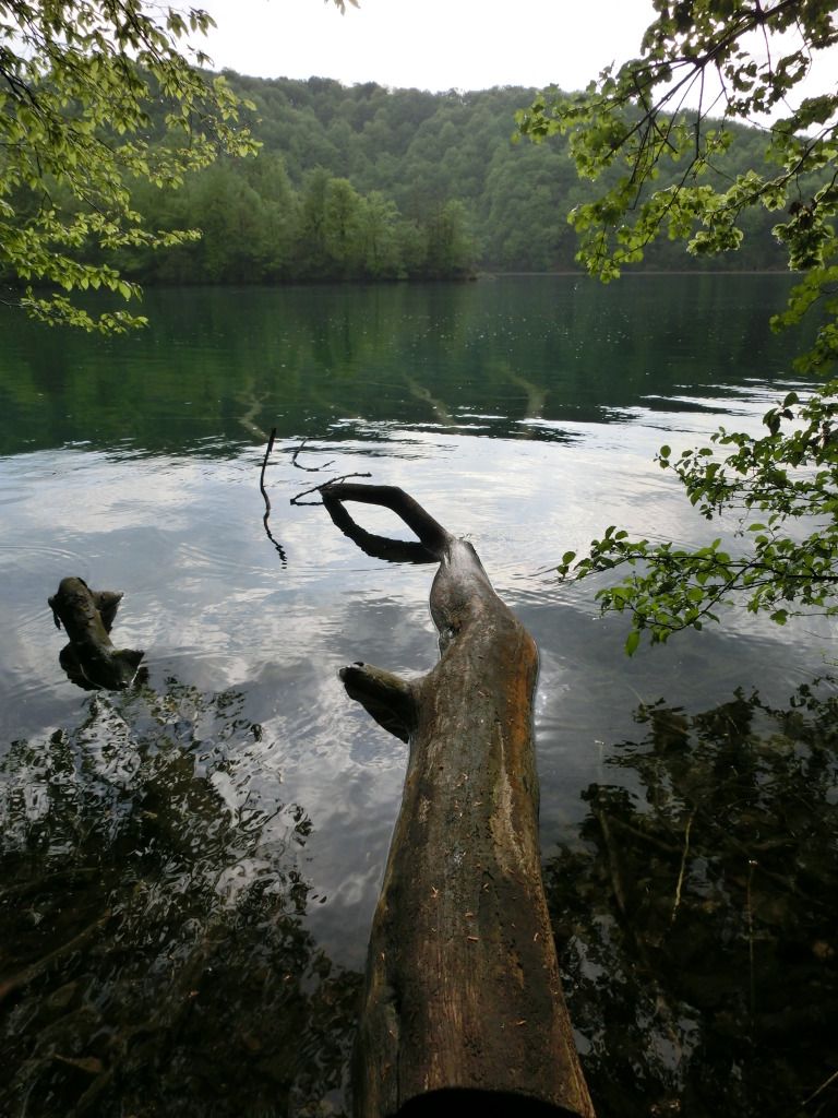
It was late afternoon by the time I settled in at the hotel in Plitvice Lakes but I wanted to visit the lakes late in the day anyway to avoid the crowd so the slight delay did not really upset my plan. Set in a lush valley, Plitvice is a series of terrace lakes, interlinked by waterfalls with miles of pleasant path and plank walks. With countless cascades and lakes that change colors constantly depending on the quantity of the minerals or organisms in the water, rainfall and the angle of the sunlight, it is indeed a natural wonderland. Many people do a day trip to the lakes but because I would rather visit late in the day and again early in the morning when there are fewer tourists, I stayed at one of the two state-run hotels minutes away from the Entrance 1. The hotel decor is dated and dull but it is comfortable and convenient plus I got a room with a good view of the lakes. The weather though was less than perfect and I found myself in a limbo at the entrance as to whether to run back to grab my poncho. Finally I got my rain gear on and started the trek along Kozjak Lake. Kozjak is the largest lake in the park surrounded by steep, forested slopes with good path that runs along to the Lower Lakes. After 40 minutes or so of walking, passing some amazing scenery of forests, steep cliffs and waterfalls, I got to the Gavanovac Lake. Above here is the open-topped cavern of Supljara, where there is a lovely viewpoint over the Lower Lakes. The image of Gavanovac with its wooden walkway that cuts across to the north bank is commonly seen on postcards, magazines and books on Plitvice. In fact, it was this very image that caught my eye some years ago as I went, 'Hey, I'd like to go there some day.'
Early next morning, I took a ferry to the Upper Lakes and started to hike from there. Along the Gradinsko, the sight of powerful waterfalls from the nearby Okrugljak lake and its reflection in the water was quite amazing. A series of cascades links Gradinsko to beautiful Galovac Lake, where an abundance of water has formed a series of ponds and falls. Moving on to the Okrugljak, I came face to face with the waterfalls I saw back at Gradinsko - I think they are the tallest that I have seen in Plitvice. The Upper Lakes are surrounded by dense forests and some of the lakes and ponds are smaller and all laced together by gushing falls. There are countless waterfalls in Plitvice and in the Upper Lakes, they are bigger, more spectacular and you can get closer to them. I definitely find the Upper Lakes more alluring. The lakes have the soothing and peaceful effect on me, especially on an overcast day but that is only when you avoid the international tour groups. It took about 90 minutes to complete my Upper Lakes circuit and from the jetty, I sailed along Kozjak on a one-way ferry to the Lower Lakes. From there, it was kind of touch and go, taking the park trolley bus back to Entrance 1 as there was a strict requirement by the hotel to check out by 12 noon.

Sunday, June 3, 2012
A Good Place To Start - The Balkans (D1/2)
In my recently concluded trip to the Balkans, I could not have done much better than starting at Zagreb. After a long flight, I really appreciated a low-key, relax and most of all, a European city not overrun by tourists. Do not get me wrong, Zagreb is anything but boring and there are actually plenty to see and do here. The first thing that greeted me though was the heatwave as it was unseasonably warm here on the last day of April. I rented a room near the bus station which in certain cities mean undesirable or unsafe location. But the neighborhood is really nice, pleasant and about 15 minutes walk to the Upper Town. Walking to the center for the first time, with the quiet streets and closed shops in the mid afternoon, I could hardly believe that I was in the capital and biggest city of Croatia. Things though were a lot livelier in the center. Trg Josipa Jelacica, the main orientation point and heart of the city is a good place to people watch as tram-loads of people get out, greet each other and disperse. Though a bit tired by then, I ventured on to the Kaptol Square. It is dominated by the 13th century Cathedral of the Assumption of the Blessed Virgin Mary (formerly known as St Stephen's). Nice but one of its twin spires was under construction. I settled for dinner at a beer garden style place near my apartment building. It was the worst meal of the trip. Why is it that the first meal on the road is seldom good?
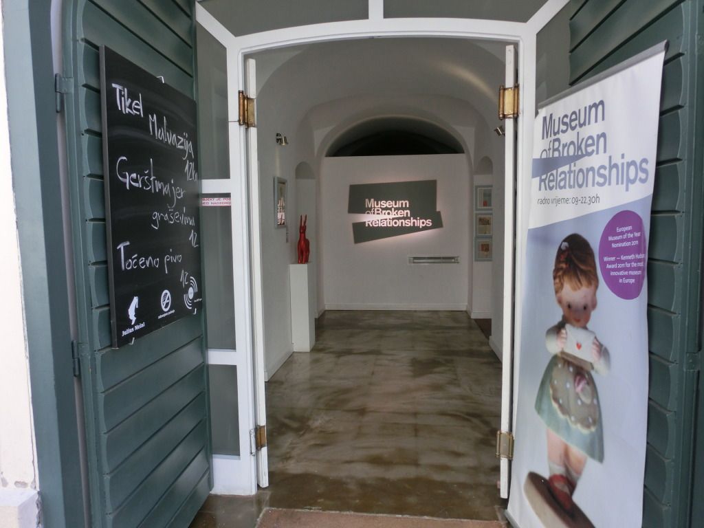
It was a Sunday and the local market next to the apartment building was closed so my plan to have a local breakfast there was off. There was not much option on the way to the center either and I was getting the impression that maybe breakfast is not a big thing here. By late morning, I finally decided to just buy a sandwich from a stand in Trg Josipa Jelacica. After my less than satisfying brunch, I began my walking tour of the Upper Town. All of the buildings here were restored or rebuilt after a massive earthquake of 1880. They now house the political and cultural centers of the country. Some of the ancient palaces have been converted into museums. There are several churches in the old town and the most notable one must be the Church of St Mark with its colored glazed tiles roof bear the coats of arms of Croatia, Dalmatia, Slavonia and Zagreb. The Dolac Market which borders between the Upper and Lower Towns was also closed that day. Back at the Lower Town, along the series of parks and open spaces, people were having picnics and other outdoor activities. The major museums are all located here and it is such a nice area to have a stroll. Dinner was pit roasted kid goat and grilled trout with almond at a restaurant near the parks. I also sampled some Croatian red wine for the first time .... the first decent meal of the trip.
 |
| quirky museum in upper town |
Saturday, April 21, 2012
Salta la Linda
I was watching an episode of The Amazing Race on TV recently that featured the city of Salta and it immediately brought back fond memories of my Argentina trip last year. In a region where the landscape and nature, rather than the towns and cities are the main attractions, Salta is the exception. At 1190 m above sea level, the capital city of the Salta Province is squeezed between steep, rippling mountains. This charming historic city in northwestern Argentina was the base for my travel to Chile. I spent one night here before moving on to the Atacama and another two more nights when I returned. With a population of less than half a million, Salta offers the facilities of a large town, retains the comfortable vibe of a smaller place, and preserves more colonial architecture than most places in Argentina. If I ever get a chance to stay in Argentina for an extended period of time, Salta will definitely be among the top of my consideration list.
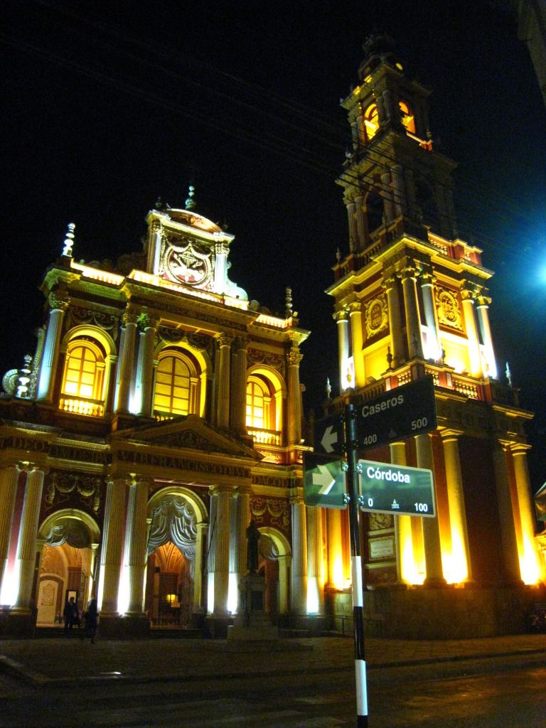
The city proudly boosts outstanding museums, plaza-side cafes and the live musica folklorica of its popular peñas. The main square - Plaza 9 de Julio - with its unique pink cathedral and surrounding streets is a great place for a stroll and people-watching. A couple of blocks from the plaza lies the magenta and yellow Iglesia San Francisco, Salta's most striking landmark. Another notable sight is the 16th-century Convento de San Bernardo but only Carmelite nuns may enter the convent. But it is during the night when the city center comes alive and turns out to be even more alluring. Salteños and surprisingly very few tourists here socialize, come for a drink or ice cream, or have a dinner in one of the many restaurants. The most stunning are the amazingly lit buildings like the cathedral and Iglesia San Francisco. During daytime they are already fantastic to see, but when it is dark, the lights and the colors make it a kind of a fairy tale. Small wonder it is nicknamed Salta la Linda.
 |
| iglesia san francisco by night |
Thursday, March 15, 2012
In Elephant Backcountry
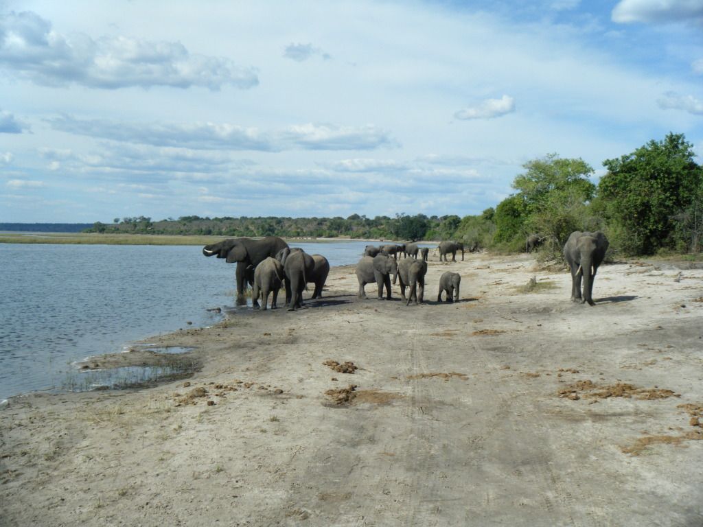
There are very few things I enjoy more on my travels than going on a game safari in Africa. Come to think of it, there are few things I enjoy more in life than that. You never know what you are going to see or happen on a game viewing activity so it is a different experience every time. The Chobe National Park in northwest Botswana was one of the game reserves that I visited during my Cape to Vic camping trip. It has one of the largest concentrations of game in Africa with an estimated 50,000 elephants, perhaps the highest elephant population of Africa. Damage caused by the high numbers of elephants is rife and apparent in some areas. We stayed in a nearby campsite and visited the park twice that day - once on a vehicle in the early afternoon and again in the late afternoon for a Chobe River sunset cruise. The first visit was on a big truck (not the usual 4X4) modified for game viewing and the tall vehicle was ideal here since it took us almost face to face level with adult elephants which I thought really enhanced the experience.

The late afternoon river cruise was even more rewarding than our earlier visit. The spacious slow ferry was able to cruise so close to the river bank where wildlife was in abundance. I also noticed that there was plentiful of bird life along the banks and I even got my first sighting of the majestic African Fish Eagle. Further from the river bank, there were scatter groups of hippos, one of the most dangerous animals in Africa. And of course, many more elephants were spotted in the water and along the river bank. What made the cruise so special and memorable was that it brought us insanely near the action - like for a while, we were barely a few meters from two adult elephants feeding in the water. The sun began to set as we turned back to the way of the jetty. So this great day at the Chobe National Park was capped by yet another beautiful African sun set...
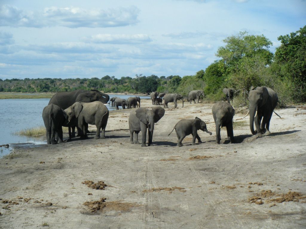 |
| elephants' paradise - scene by the chobe river |
Saturday, February 4, 2012
Looking Down the Devil's Throat
It has been six months since I wrote about my amazing flight into the Iguazu Falls and I thought it was long overdue to share the pictures of the rest of my visit here. With more than 250 separate cascades, varying between 60m and 82m high at heights and spanning 2.7km (1.7 mi), the Iguazu Falls is one of the largest waterfalls in the world. Based in Puerto Iguazu Argentina, I started off by spending an afternoon on the Brazilian side (Foz do Iguaçu) of the falls. The Parque Nacional do Iguaçu is designed in such a way that with every twist of the path reveals a more splendid view as you edge closer to the Devil's Throat (Garganta do Diabo in Portuguese) - an extended platform leading to the edge of the falls. Since 80 percent of the falls is in Argentina, the overview here, the river and the jungle below is nothing short of spectacular. There is an ever-present rainbow from all the moisture. To think that at one point, I was about to give up crossing over because of some problem with my visa application and if I did, that would be a real shame.
There are two trails - an upper and lower trail at the Parque Nacional Iguazú in Argentina. I did the upper trail first and it was built mainly on the falls offering some stupendous vistas of the falls. The the lower circuit involved much more climbing, but was even more beautiful. The lower trail is prettier from a nature standpoint. It does not get as close to the falls, but gives better views. After completing both trails, it was time for me to go to the Devil's Throat (Garganta del Diablo in Spanish). A kilometer-long trail leads directly to the falls of the Devil's Throat, the highest and deepest of the falls. The part with the largest volume of water is the narrow horseshoe of the Devil's Throat and it is also the portion that is split between Argentina and Brazil. The Garganta is something that pictures just cannot capture nor do justice with. The main falls are thunderous. Water tumbles off of them and smashes onto the rocks below with such force you cannot even see the bottom through the violent mist. Downstream, smaller falls are arguably even more beautiful.The trail takes you as close as you would want to be, occasionally being misted into oblivion by shifting winds. I am struggling for words to describe this feeling...
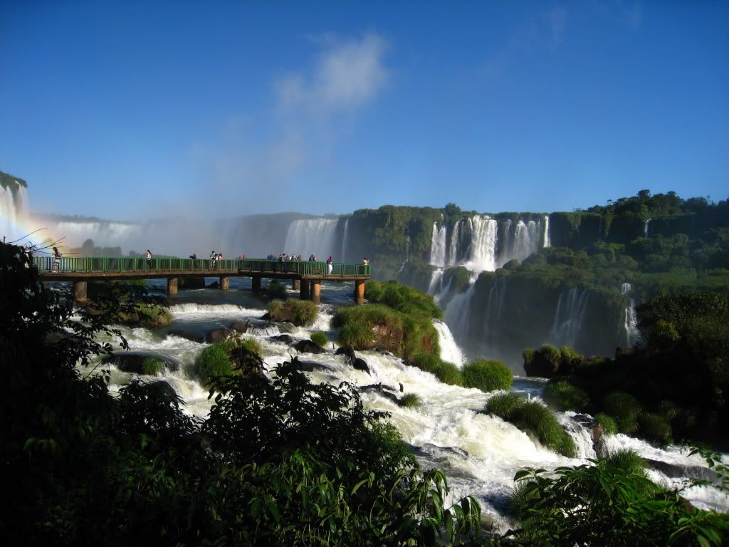 |
| the devil's throat in brazil |
Thursday, January 12, 2012
Old World Charm
I like to observe and photograph traditional old buildings and architectural works. Recently while in South Korea, I had the opportunity to stay and visit some of the hanok or traditional home villages. My first experience was the protected historic housing district of Samjicheon Village in Damyang. Although it is not a big or extensive village, it is certainly the one I find most appealing and worth every effort to get there. The hanok that I stayed in was tucked inside a charming alley lined by stacked-stone walls - a perfect illustration of the idyll of country life. I was lucky to arrive just before the sun set - excellent natural light condition for photography of the autumn colors. I opted for a slightly pricier room that came with ondol or traditional heating system where firewood are placed underground beneath the room. That evening, I was also invited to attend a traditional tea ceremony hosted by the friendly hanok owner and his wife.
With over 700 traditional Korean hanok houses, the Jeonju Hanok Village in the city of Jeonju is the largest hanok village in Korea. There are traditional culture learning centers such as art crafts exhibition halls, master products exhibition centers, Hanok Living Experience centers, traditional alcohol museum and others. Many traditional and historic sites like the Gyeonggi Palace and Jeondong Catholic Church are excellently preserved. There are also tea shops and restaurants but what fascinates me is the high number of western styled cafes that are housed in hanok found here. There is a big cafe culture in Korea and the village has not been spared of that and unlike some of the older local folks that I have spoken to, I quite fancy the bit of old and modern mixed here.
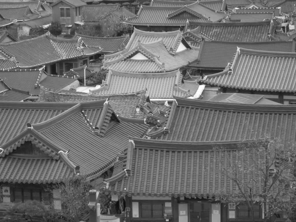 |
| unique roof shape of jeonju hanok village |
With over 700 traditional Korean hanok houses, the Jeonju Hanok Village in the city of Jeonju is the largest hanok village in Korea. There are traditional culture learning centers such as art crafts exhibition halls, master products exhibition centers, Hanok Living Experience centers, traditional alcohol museum and others. Many traditional and historic sites like the Gyeonggi Palace and Jeondong Catholic Church are excellently preserved. There are also tea shops and restaurants but what fascinates me is the high number of western styled cafes that are housed in hanok found here. There is a big cafe culture in Korea and the village has not been spared of that and unlike some of the older local folks that I have spoken to, I quite fancy the bit of old and modern mixed here.
Friday, December 2, 2011
Mystical Miscanti
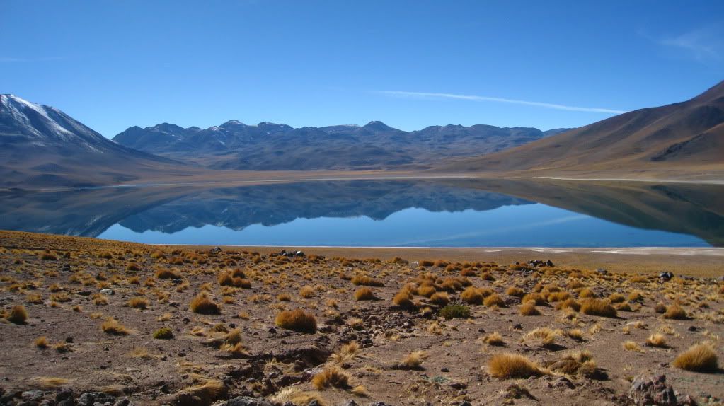 |
| this would have been perfect if my camera came with wide-angle lens |
At a dizzying height of more than 4200m above sea level, nestled in the Andes lies another mezmerizing sight looking like an abstract painting. The two shimmering blue lagoons doted over by volcanos are simply gorgeous, and typical Andean scenery. The Miscanti is the bigger and more imposing of the two with visible snow on the volcano. Significantly smaller but just as alluring is the Miñiques. The lagoons are nesting sites for birds so we are not allowed to walk outside the designated area and path. This area is also a good place for spotting vicunas, Andean foxes and other wildlife.My Day 4 (final day in Atacama) tour concluded with a visit to the prehispanic village of Toconao - a sleepy town with a narrow plaza and a small church.
Tuesday, November 1, 2011
The Other Acropolis
Recently a co-worker brought up the subject of traveling in Greece and she told us how her friend was looking forward to see the iconic Acropolis in Athens. It prompted me to write and share my photos on my visit to Rhodes (Rhodos) last year. Closer to Asia Minor than to the Greek mainland, Rhodes is the largest of the Dodecanese islands in terms of both land area and population. I stayed in a simple but lovely hostel at the heart of the medieval Old Town. It is one of the oldest inhabited medieval town in Europe and I easily spent an entire day visiting the sites around this ancient walled city. Another good way of seeing the Old City is just by walking around the outside. The fortification has a series of well-preserved gates and towers, and is remarkable as an example of a fully intact medieval structure.
The town of Lindos, 45 km to the south of Rhodes town, is a beautiful little village of white cubist house and winding cobblestone streets at the foot of a vertical rock that is crowned by the Acropolis of Lindos. Before I read up for my visit to Greece, the only acropolis that I knew of was the iconic Acropolis of Athens. Having seen both, I think the Acropolis of Lindos is by far more picturesque from a distance and from the ruins itself because facing the sea, it offers dramatic views of the surrounding harbors and coastline. And on the day of my visit, it was for free admission to the public. I should be so lucky.
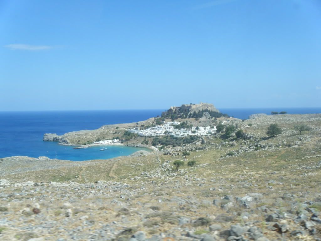 |
| acropolis of lindos pic taken from a bus |
Subscribe to:
Posts (Atom)
